Sonia Tsakni
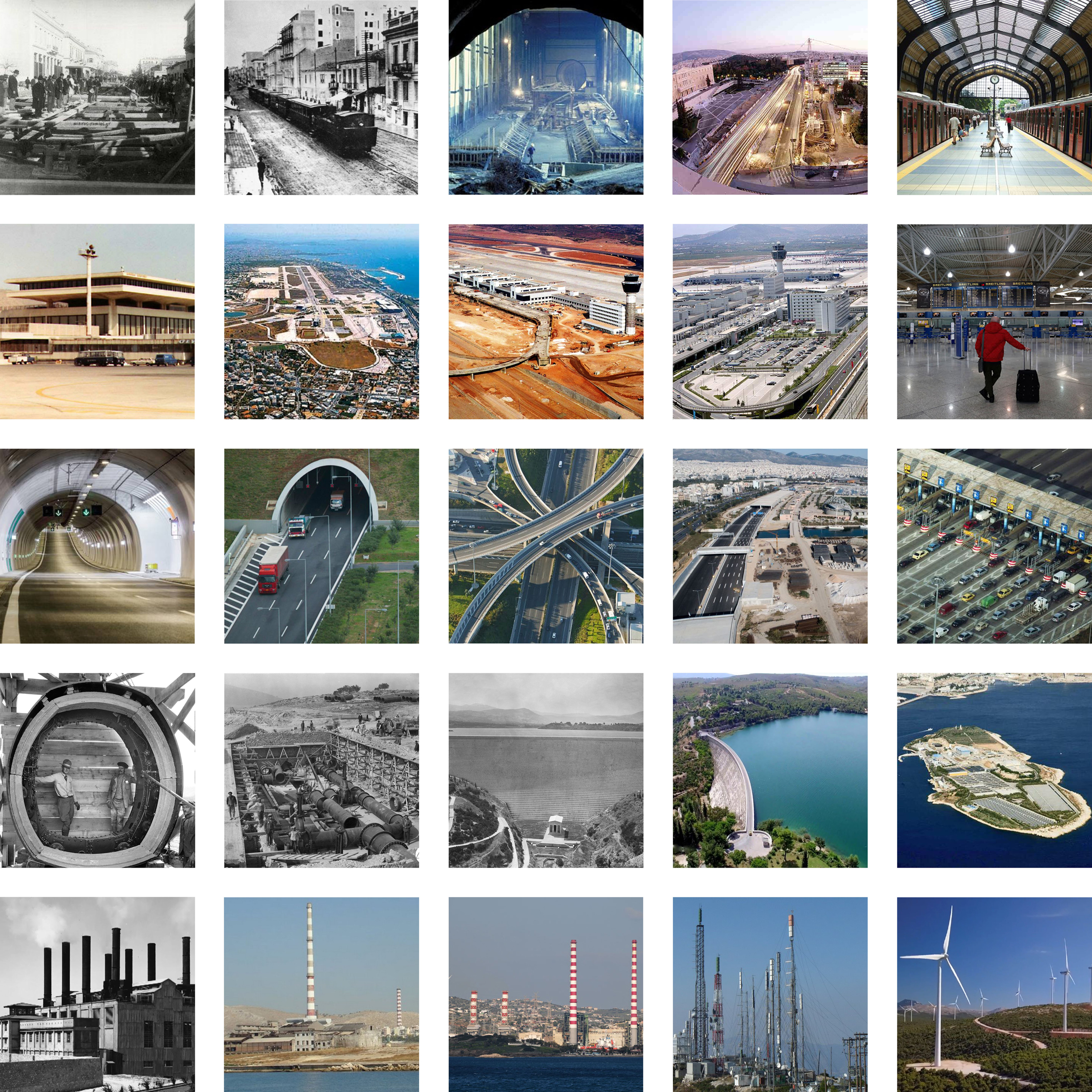
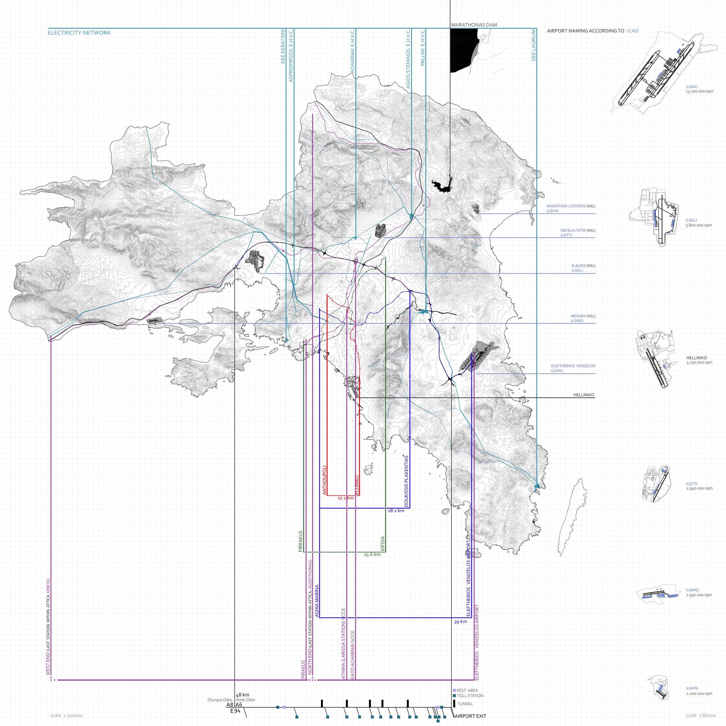
Some of the most important infrastructure of Attica is a result of mass infrastructure development that took place, before the 2004 Olympics. These were either completely new projects, (like the Eleytherios Venizelos Airport and Attiki Odos, both operating since 2001) or expansions to existing ones (like the additional metro lines, operating since 2000). Other significant infrastructure is the (Proastiakos) Suburban Railway, the electricity network and the Marathon Dam which opened in 1929 and supplied water to Attica.
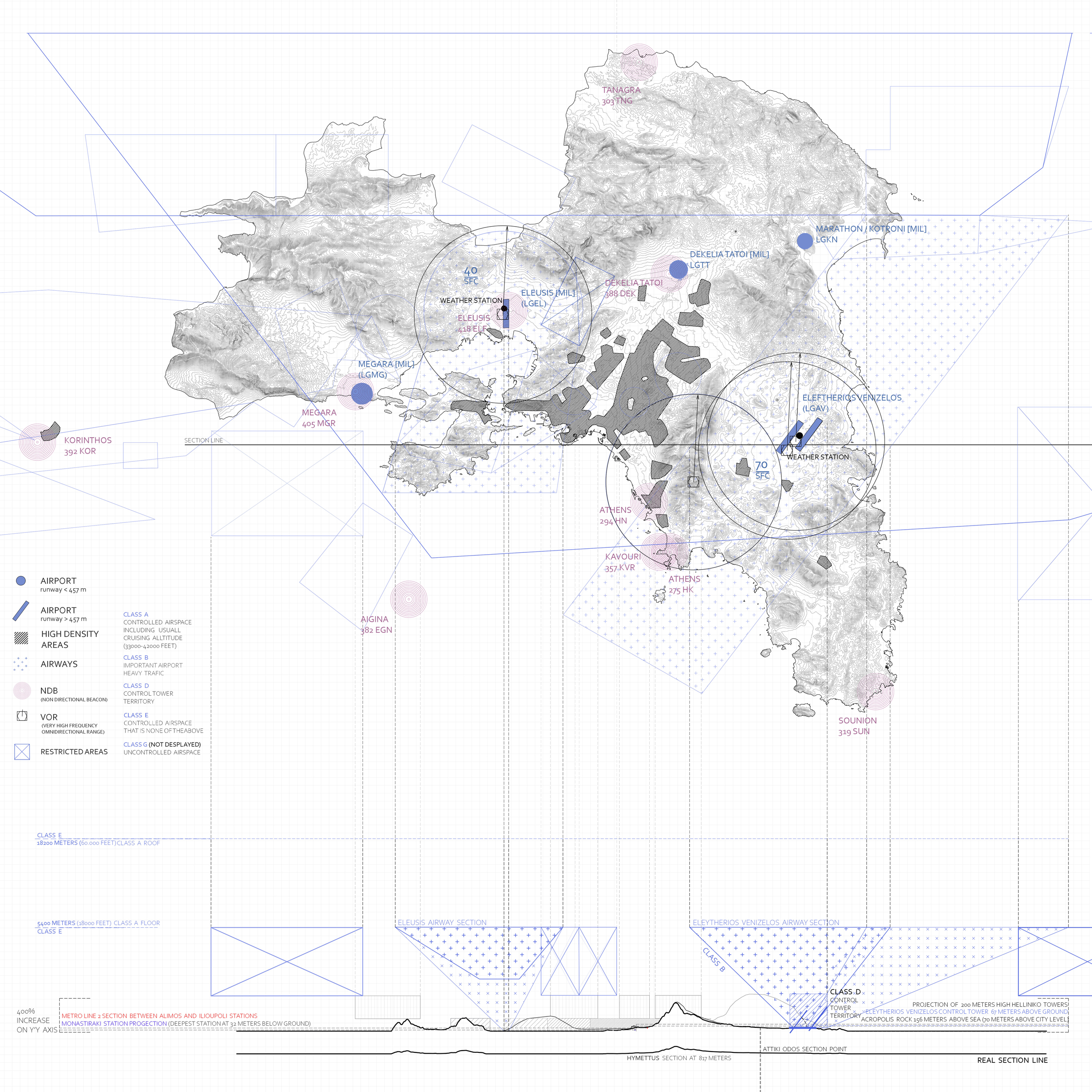
All of the Attica airports have been located and have been studied as far as their imprint on the ground but also their impact on the Attica airspace. The airspace above a city or country, has borders and territories which have dimensions, just like the land underneath.
Considering the nature of a map or drawing, which is a depiction of points on a two-dimensional plane, measurements and coordinates are depicted under scale and are always affected and/or manipulated. Some of the most famous maps have been depictions of those interest points without them corresponding to actual measurements but maintaining a comparative relationship, just like every metro or subway system map. (The first schematic London Underground Map was designed in 1931). Having this in mind there has been an effort to understand and explore the importance of coordinates and their manipulation process, when constructing a map or graphical depiction of interest points, which in this case are Metro and (Proastiakos) Suburban Railway Stations.