Sonia Tsakni
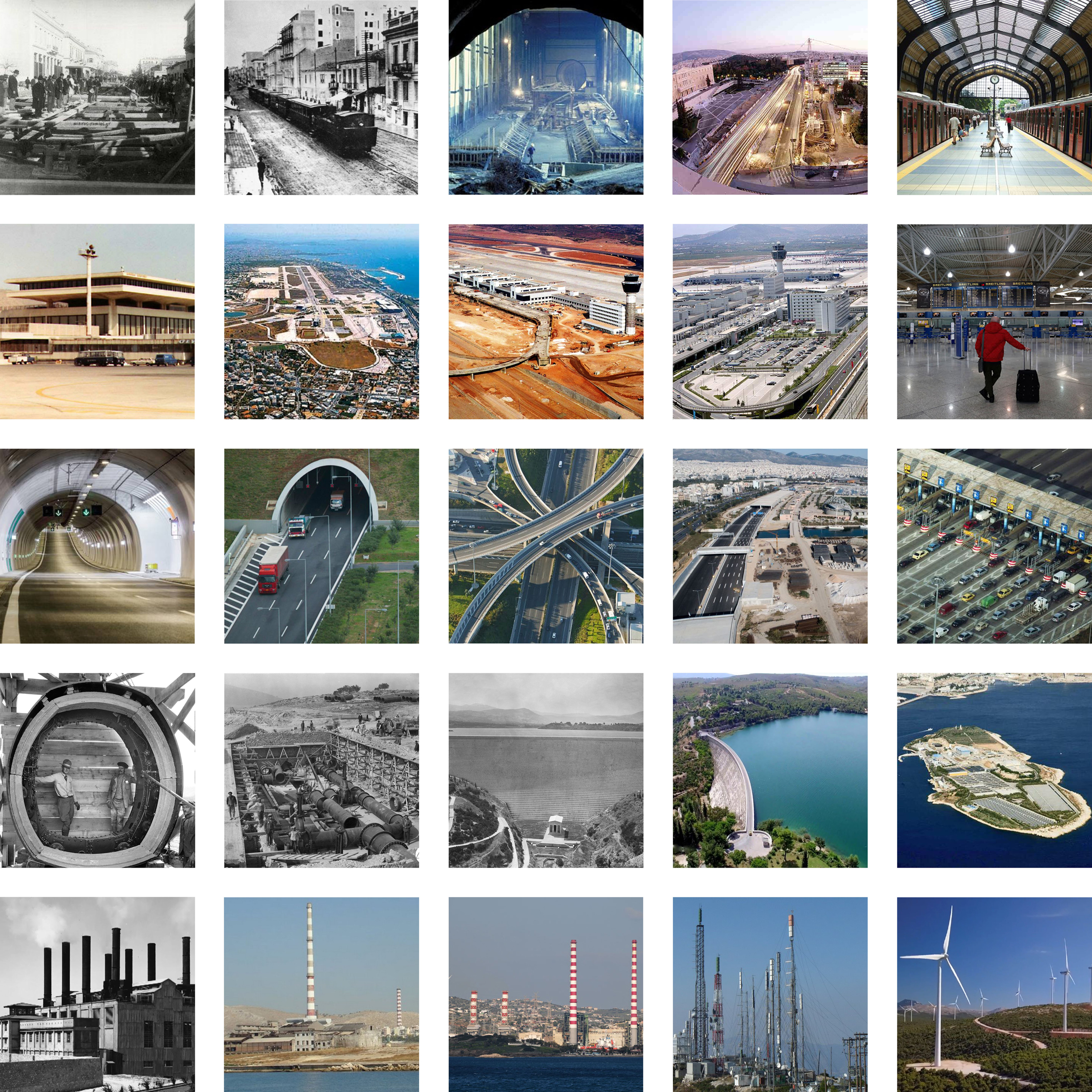
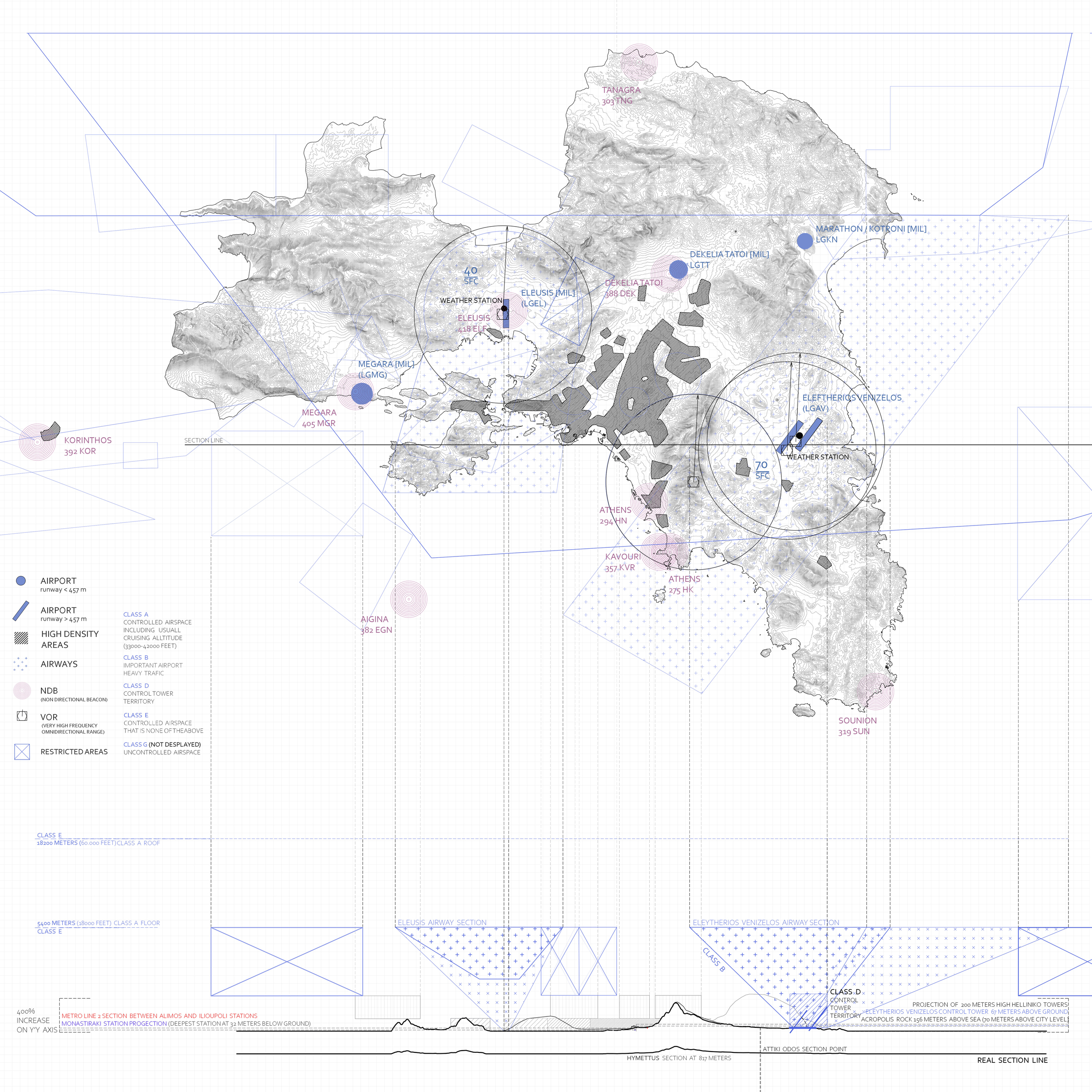
Some of the most important infrastructure of Attica is a result of mass infrastructure development that took place, before the 2004 Olympics. These were either completely new projects, (like the Eleytherios Venizelos Airport and Attiki Odos, both operating since 2001) or expansions to existing ones (like the additional metro lines, operating since 2000). Other significant infrastructure is the (Proastiakos) Suburban Railway, the electricity network and the Marathon Dam which opened in 1929 and supplied water to Attica.
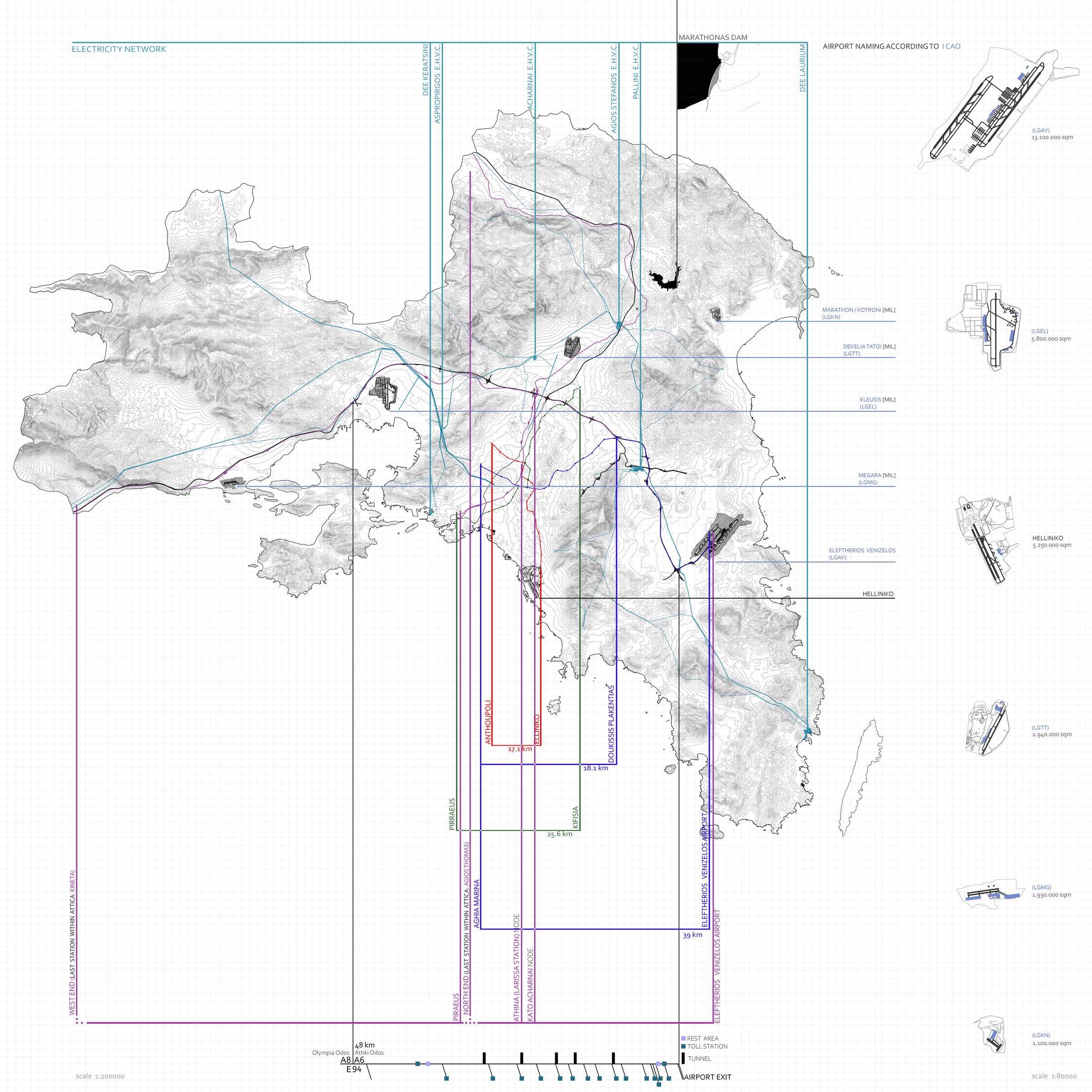
All of the Attica airports have been located and have been studied as far as their imprint on the ground but also their impact on the Attica airspace. The airspace above a city or country, has borders and territories which have dimensions, just like the land underneath.
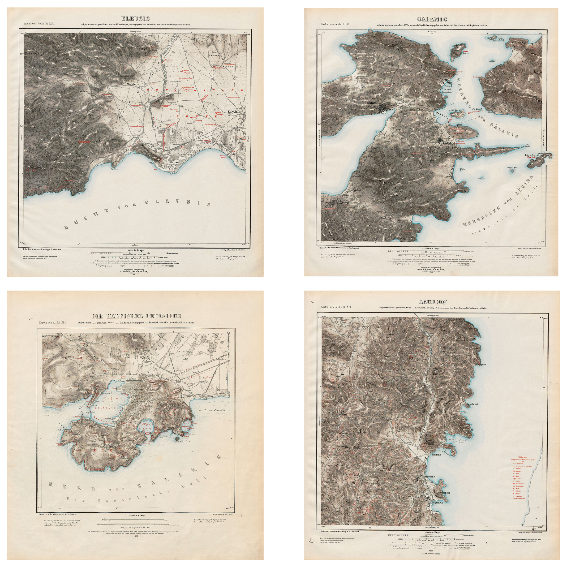
Considering the nature of a map or drawing, which is a depiction of points on a two-dimensional plane, measurements and coordinates are depicted under scale and are always affected and/or manipulated. Some of the most famous maps have been depictions of those interest points without them corresponding to actual measurements but maintaining a comparative relationship, just like every metro or subway system map. (The first schematic London Underground Map was designed in 1931). Having this in mind there has been an effort to understand and explore the importance of coordinates and their manipulation process, when constructing a map or graphical depiction of interest points, which in this case are Metro and (Proastiakos) Suburban Railway Stations.
marine infrastructures & networks
Maria Tsalavouta
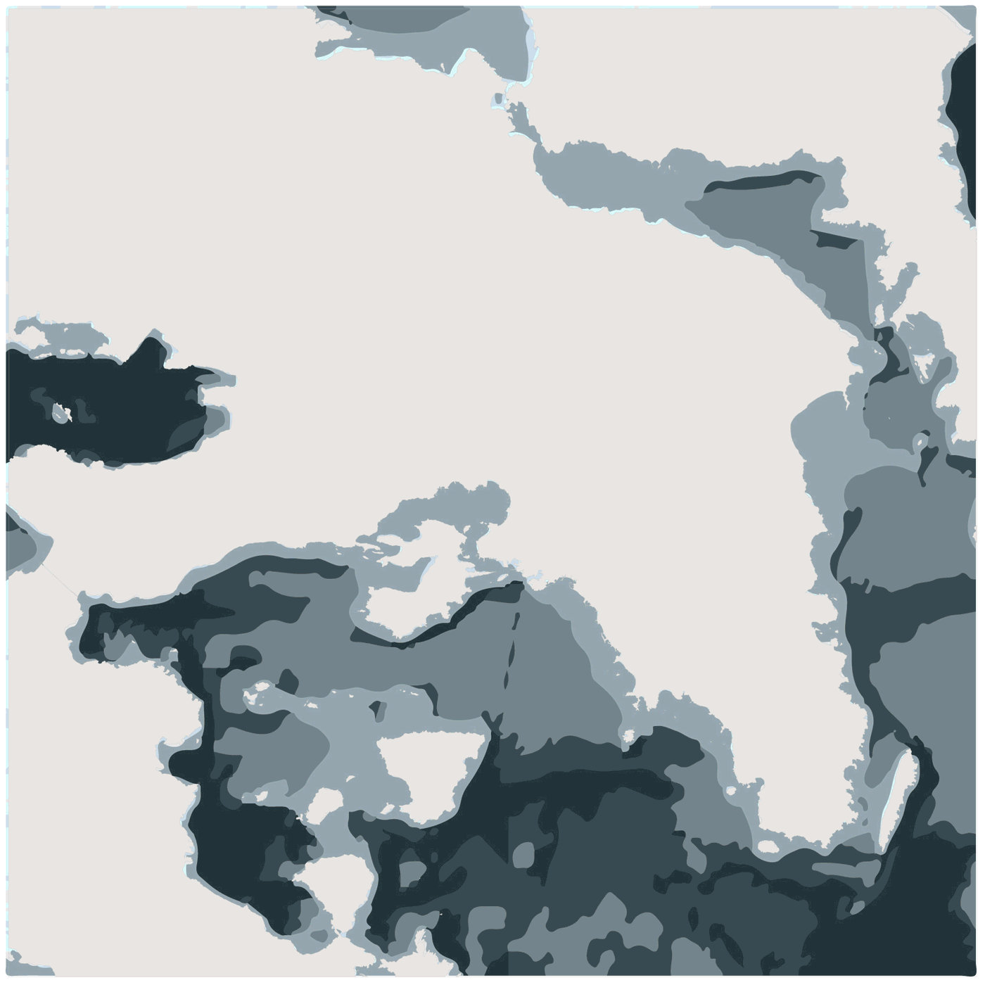
The coastline of Attica contains a variety of marine infrastructures. Those have shaped the identity and topography of the seaside front, while also redefining touristic and commercial activities. Sea infrastructures are considered points of entry and exit for Attica, thus creating connections between the mainland and the islands. The density of those points on a geographic location indicates the impact the marine connections have.
The sea has also been studied along with the coastline. The bathymetry provides the basic layers in which the sea has be observed and depicted. More layers are added in the form of restricted areas. Those areas are affected by aforementioned infrastructures and point out human interference and appropriation.


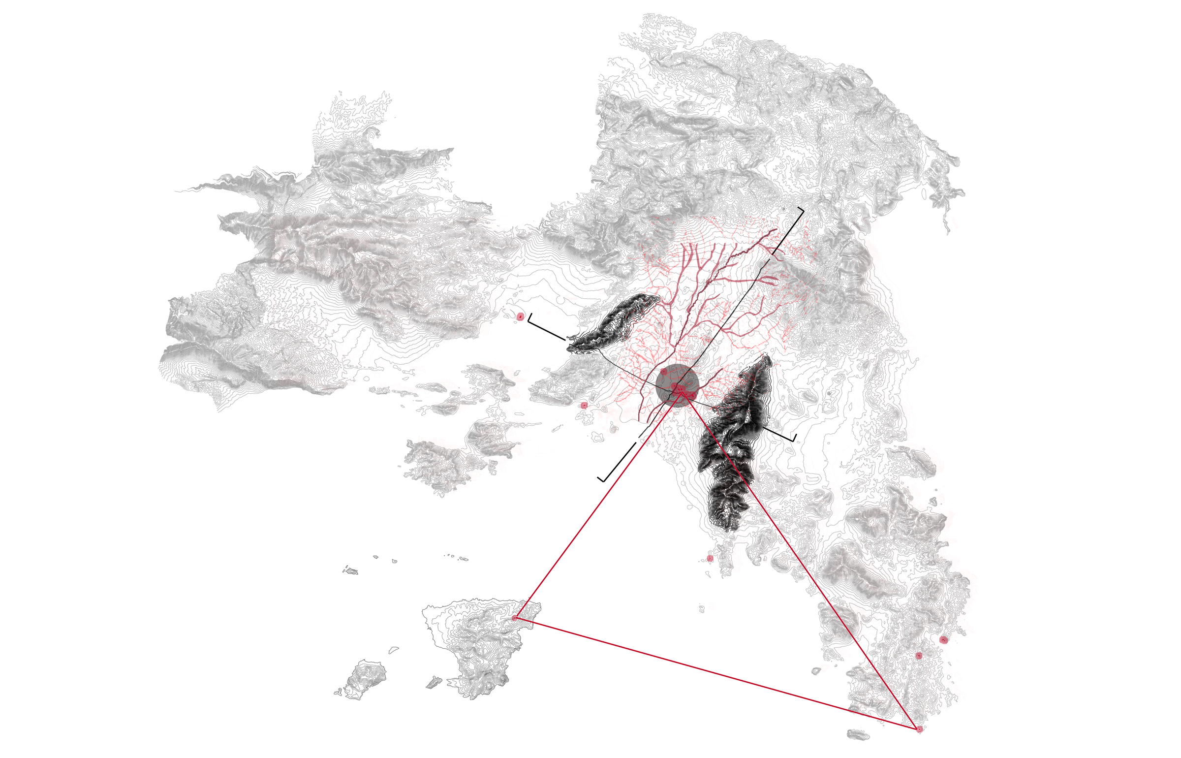
water systems
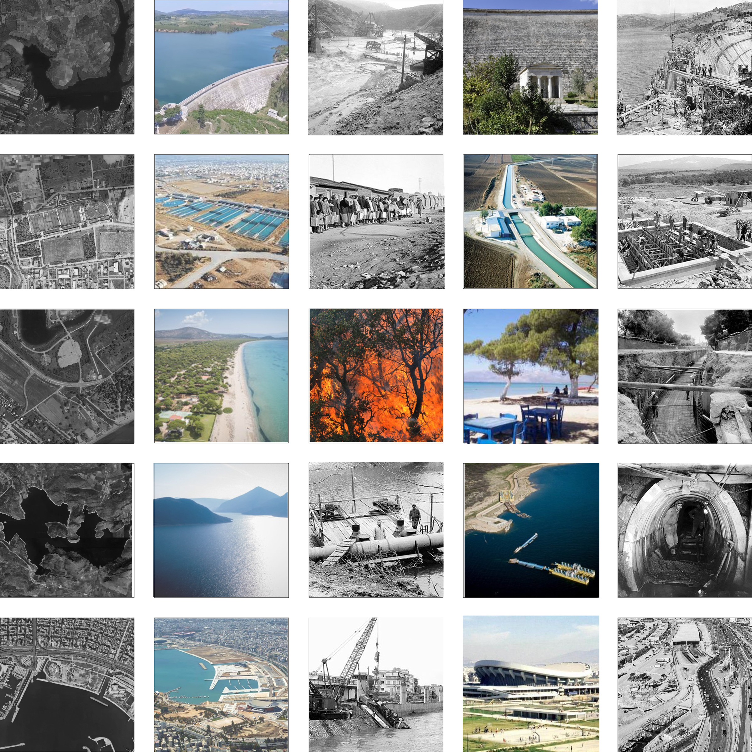
Dimitris Odysseas Perkizas
| Mainland Rivers Mountains Sea A fully water surrounded area, but not communicating with. Rivers covered by highways, abandoned ports and infrastructures, disadvantaged green areas. Attica is a unique natural landscape, with a big number of rivers that I focused to. Big and small, covered or not, I pointed the flowing way to the sea. This huge deposition of water, we could also say it’s covered by human activities too, either in the centre, or around the coastline. In those two connected systems, I added the water supply operation system, which is also big around Attica’s ground and looked its flowing activity, begging from the artificial lakes of Yliki and Marathon, leading down to the water management infrastructures. So those flowing waters make a big deposition system under the city, connected with big constructions on the ground and in the sea, creating a wonderful relationship of what is natural and what was built by humans, making us wonder how would be like to live on, in, or under the water and how we can learn to cooperate with. |
 |

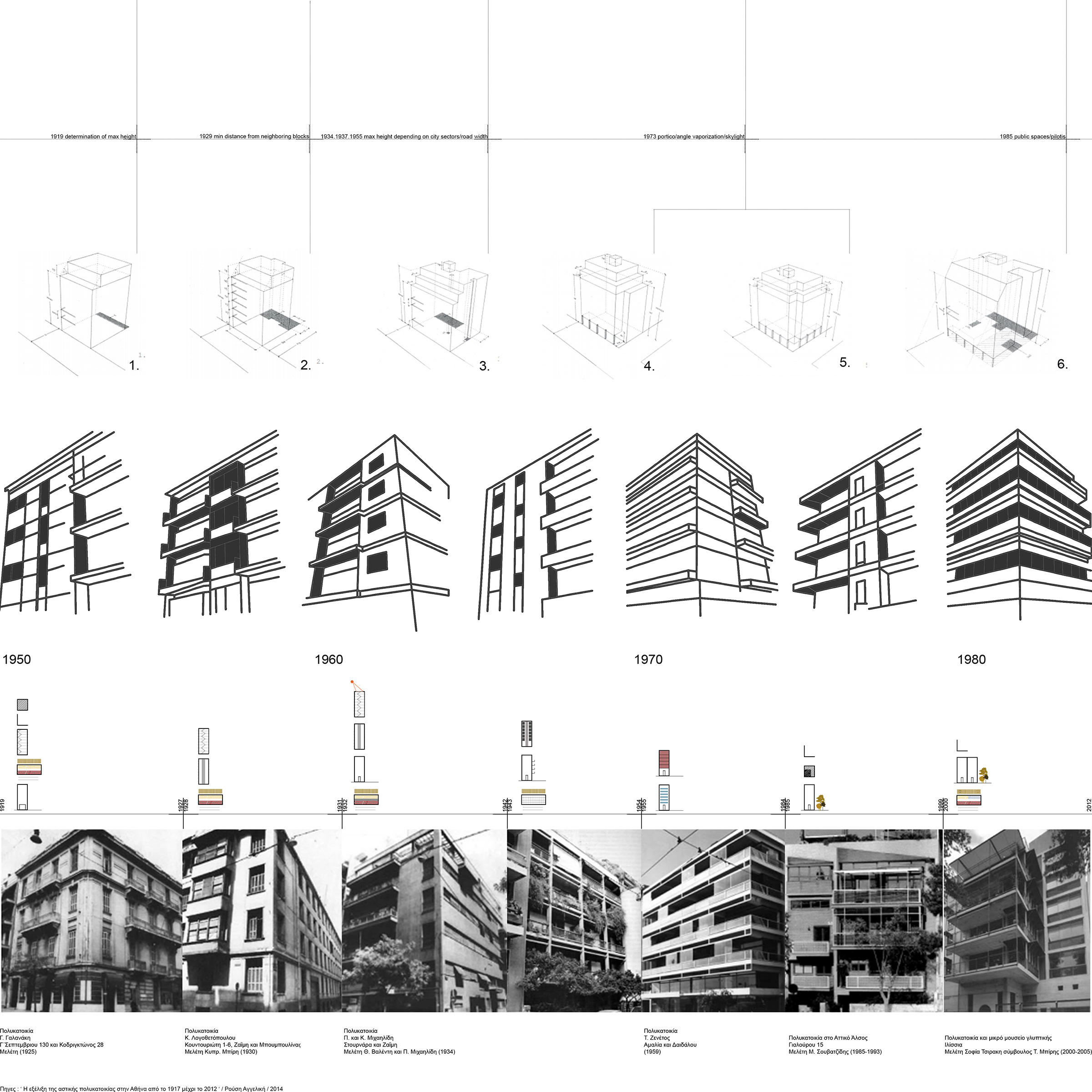
polykatoikia
Marilina Katsikerou, Eva Stamataki
|
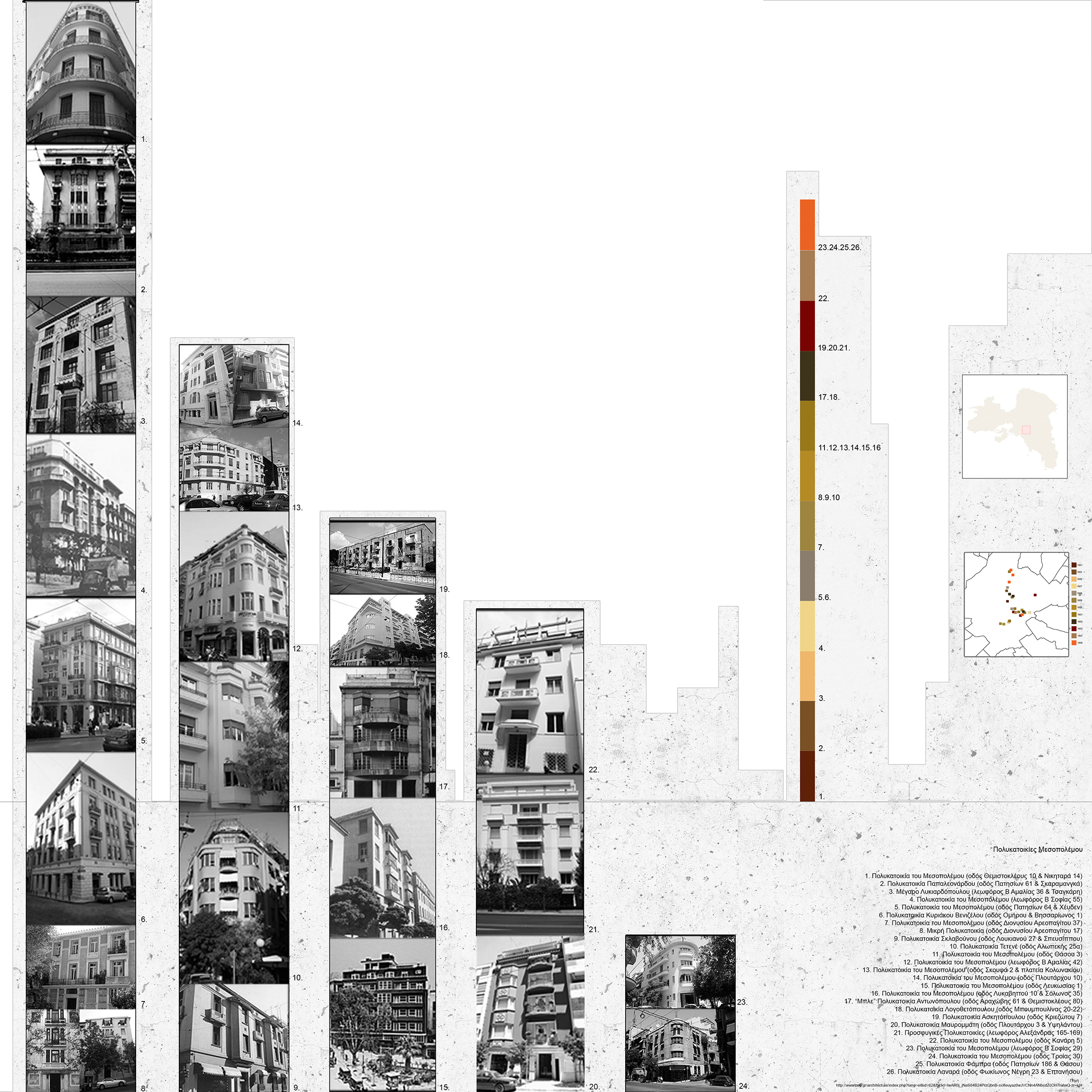
Exploring Attica, we focused our research on the residential
development of Athens and the areas around. In an urban environment that is
created mostly without a plan, its form depends on the topography. Athens is
surrounded by three mountains and has a large front towards the Mediterranean
Sea. The urban fabric density varies, and a strong connection exists between increasing population and a need for extra space. That is why the first apartment buildings appeared in the city center. A walk around Athens reveals some of them while others were not treated properly and remain hidden in gray areas of the city. We tried to follow the evolution of the Athenian apartment building as well as highlight some of the oldest ones from the first half of the 20th century (1900-1940). |


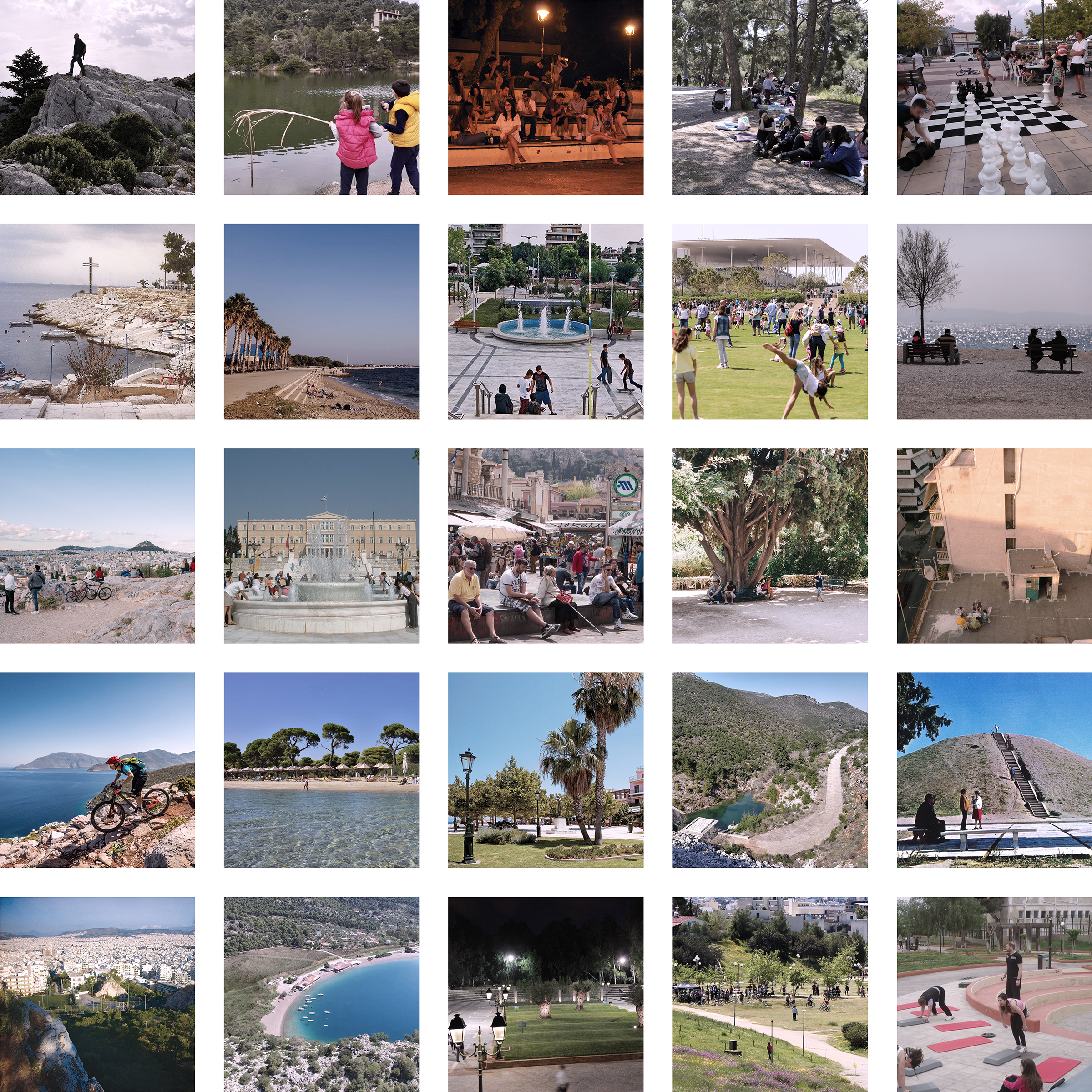
commons
Georgia Papalexandri, Maria Vourloum
Public spaces in Greece usually come coincidentally, as a leftover void in the built environment, and not as a result of specific initiatives to enhance the urbanity and the circulation. Their identity is constituted from a mosaic of spaces such as public squares, pedestrian areas, beaches, parks, forests, groves and common sport areas.
The quality of public spaces reflects the standard of living of the citizens and shows the economical and social relationships. A well designed space can contribute to the improvement of the around neighborhoods, separate them from the heavy traffic roads, act as a recreation area and bring the citizens closer to nature. Therefore their existence is of utmost importance for the future of the cities.
We directed our research in the finding and registration of these spaces in the region of Attica and compared them with the population density, the road network and the public transport. Thus, arised a categorization of the public spaces in local, supra-local and metropolitan, according to their importance for Attica.
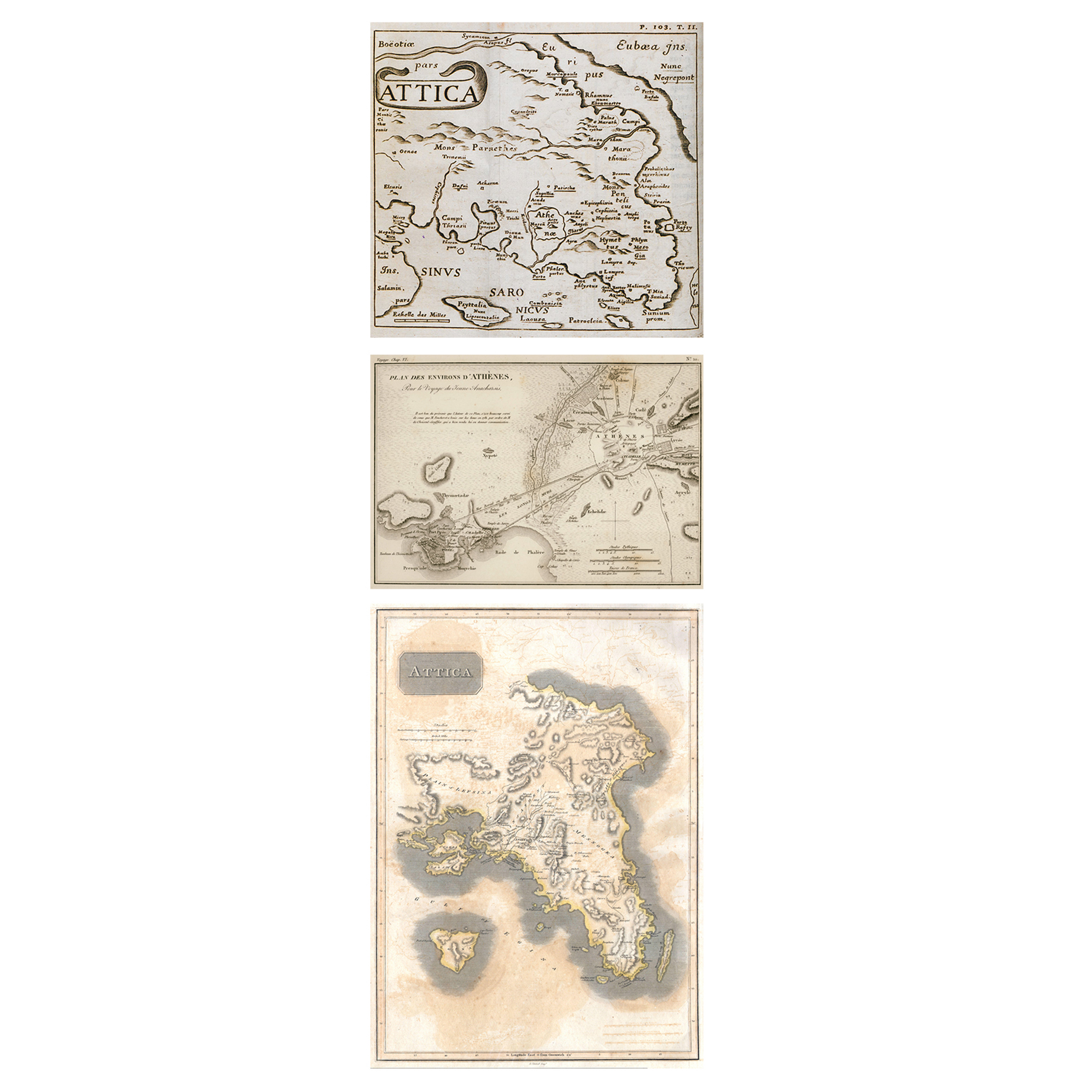
© Map of Attica, 1678,
SPON, Jacod. Voyage d’ Italie
© Athens and the Piraeus with the Long Walls and the harbors of Athens, 1832, BARTHELEMY, Jean Jacques
© Map of Attica (Athens and Vicinity), 1815, THOMSON, John. New General Atlas
© Athens and the Piraeus with the Long Walls and the harbors of Athens, 1832, BARTHELEMY, Jean Jacques
© Map of Attica (Athens and Vicinity), 1815, THOMSON, John. New General Atlas


tourism
Mara Angelou
Greece is one of the top tourist destinations in the world and especially Athens, which attracts the largest number of visitors. Over the last 4 years, the spread of Airbnb has been steadily increasing. Accommodation in an area, is no longer done in hotels, hostels or apartments, but in renting entire houses or subletting rooms in houses.
In our research on accommodation in the Attica region, we were confronted with the huge number of Airbnb in relation to hotels, which is increasing day by day from 2017 until today. We noted the areas that tourists visit, depending on the number of accommodation, their type and the nights of their stay, we made a profile of each area and the type of tourist visiting. For example, in South Attica, visitors prefer larger houses, with more amenities and for more days, while in the center they prefer one bedroom houses and for fewer days.
Through this research we can have a clear picture of the area involving tourist accommodation and reflect on the Airbnb phenomenon.


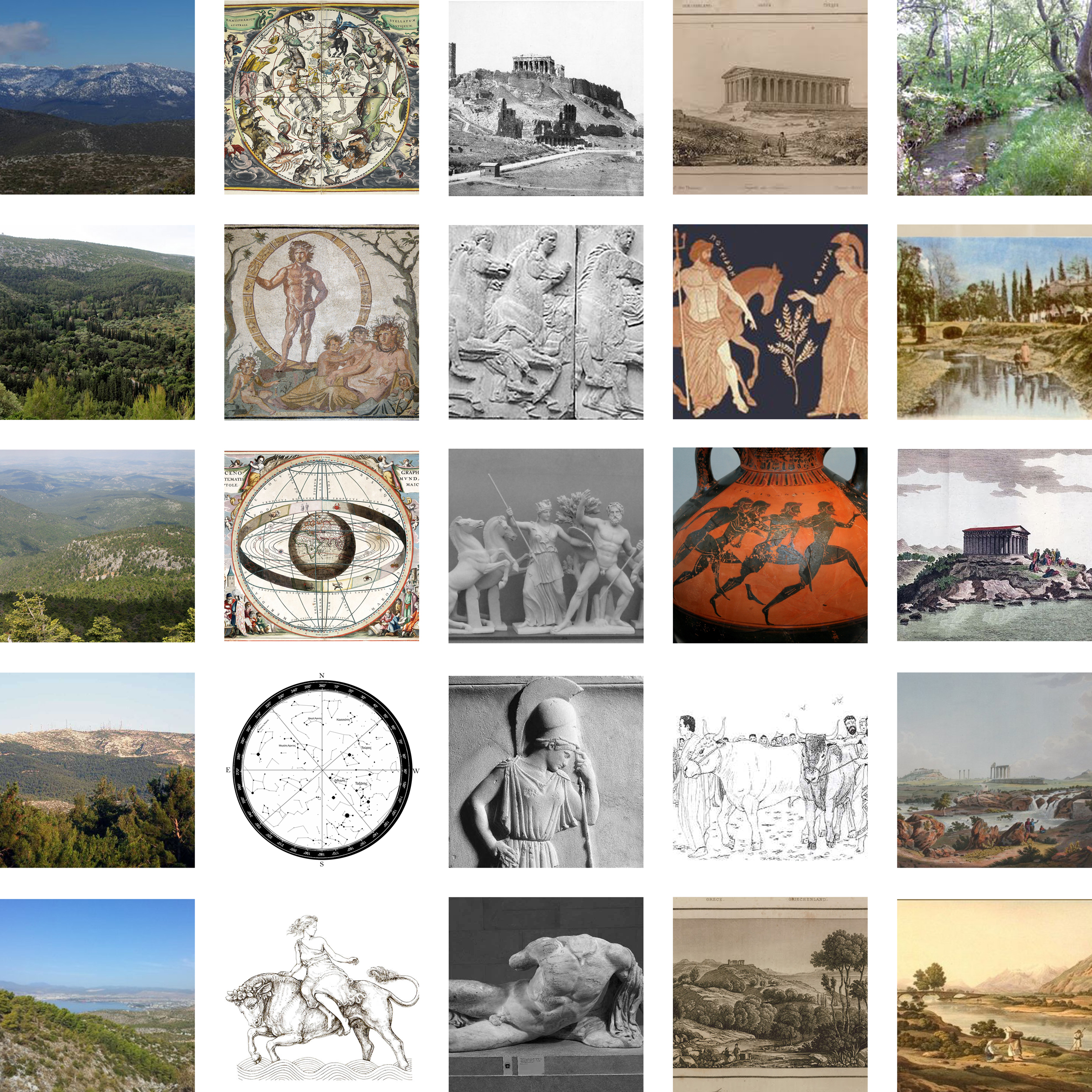
topos & mythos
Vaso Aidonidou

states of emergency
Dora Kounavi
|
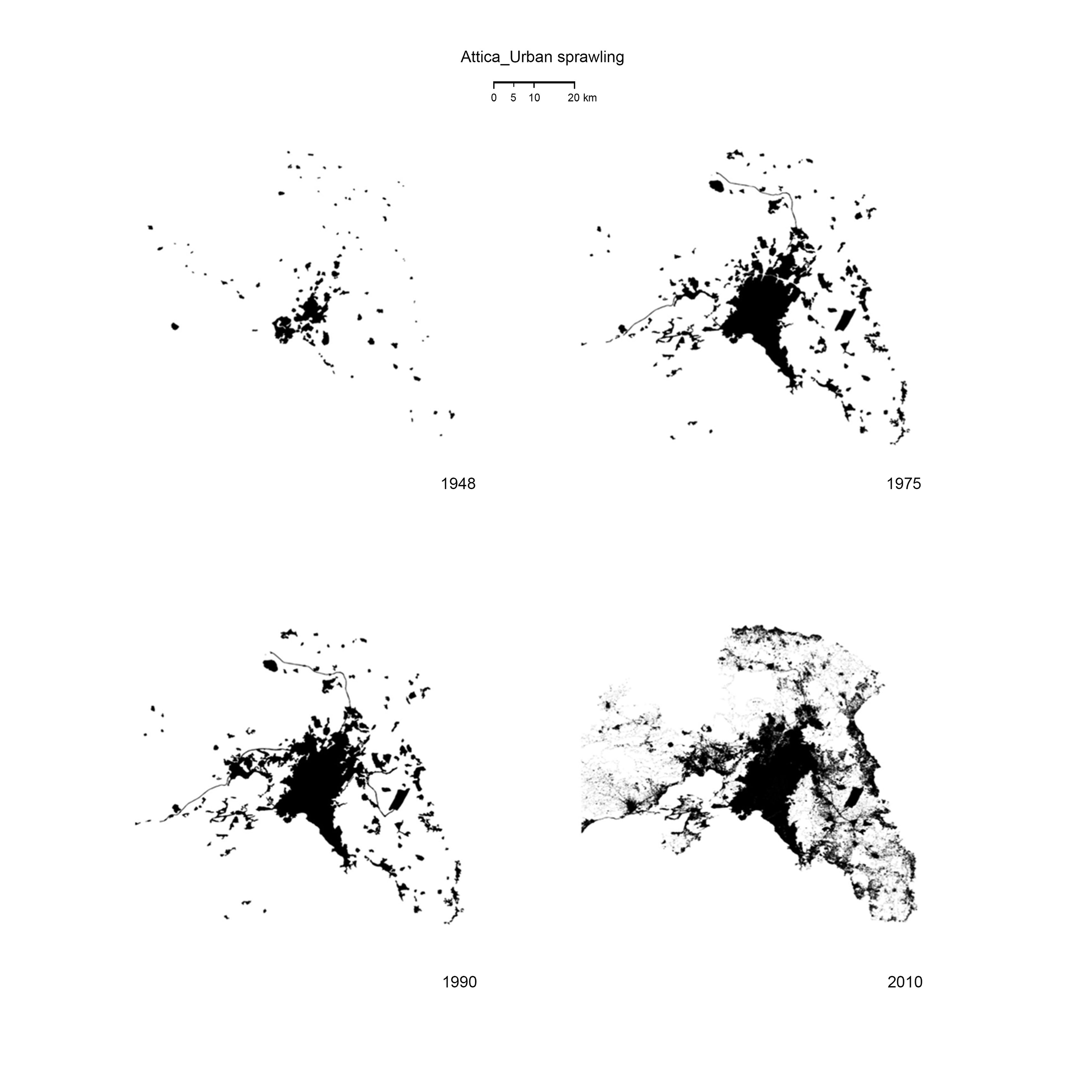
The displacement of people is not a new phenomenon in the history of Attica. A variety of causes – usually severe or traumatic as war, earthquakes, environmental disasters, etc. – would always trigger migration of various groups. Layered on top of the domestic impact on Attica’s landscape was the 1922 refugee crisis. Hundreds of thousand refugees arrived at Piraeus Port from the shores of Asia Minor seeking for shelter. Both migrants and Greeks were unprepared for this and had to adapt from providing short-term care to providing longer-term installation. Once – unoccupied rural areas had been transformed into urban cells to accommodate the homeless’. Such an operation took five decades to be completed. In the meantime, the urban sprawl was consuming more and more the space in-between the initial settlement cells and the towns of Athens and Piraeus. The nowadays imprint on the Attica basin is still part of the collective memory Greeks are sharing. A smaller scale displacement was recorded after the 1999 devastating earthquake, but the majority of the shelters were temporary. Only a few areas are spotted nowadays. It seems that Attica’s urban profile consists of fragments, where the new is finally adapted by the old. 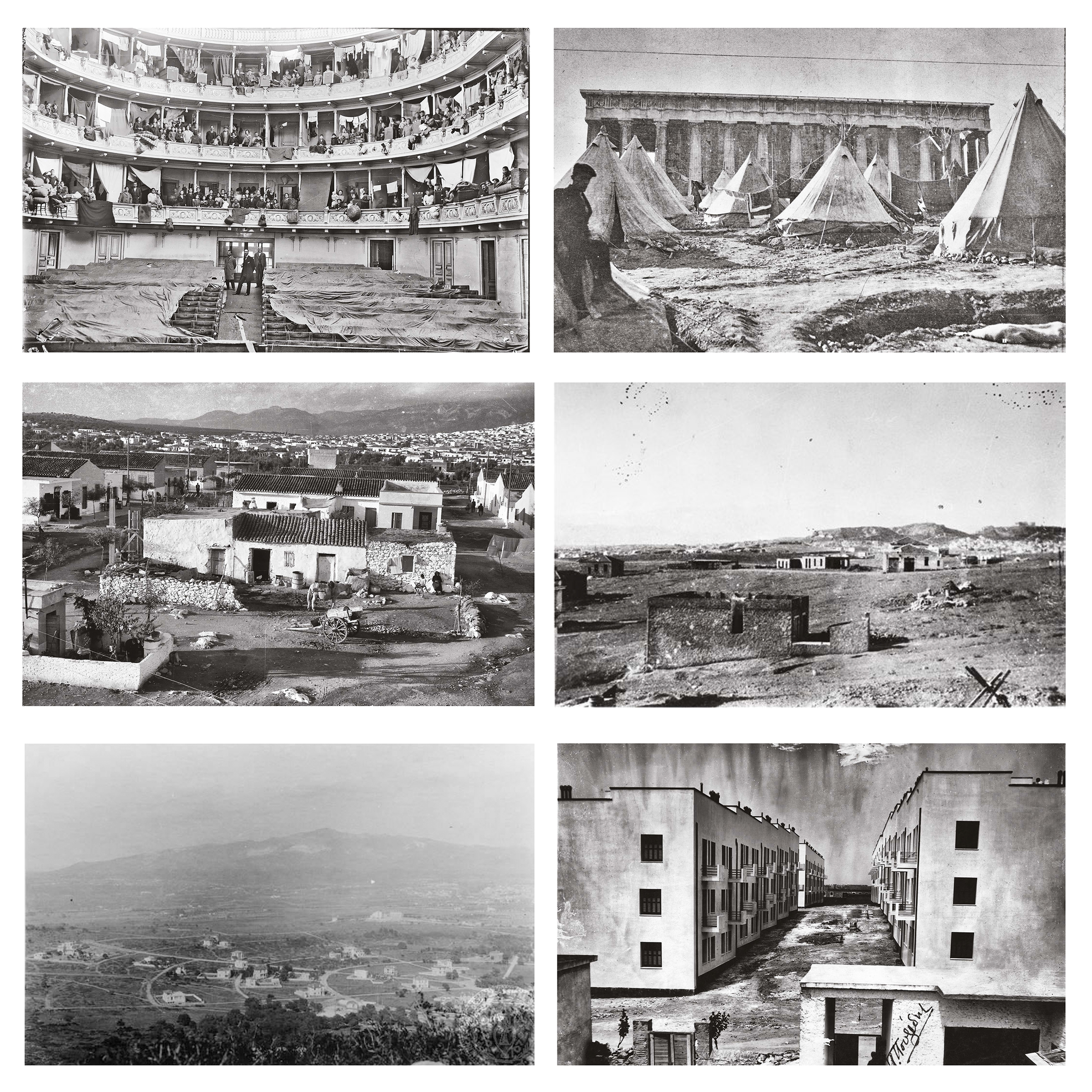  |
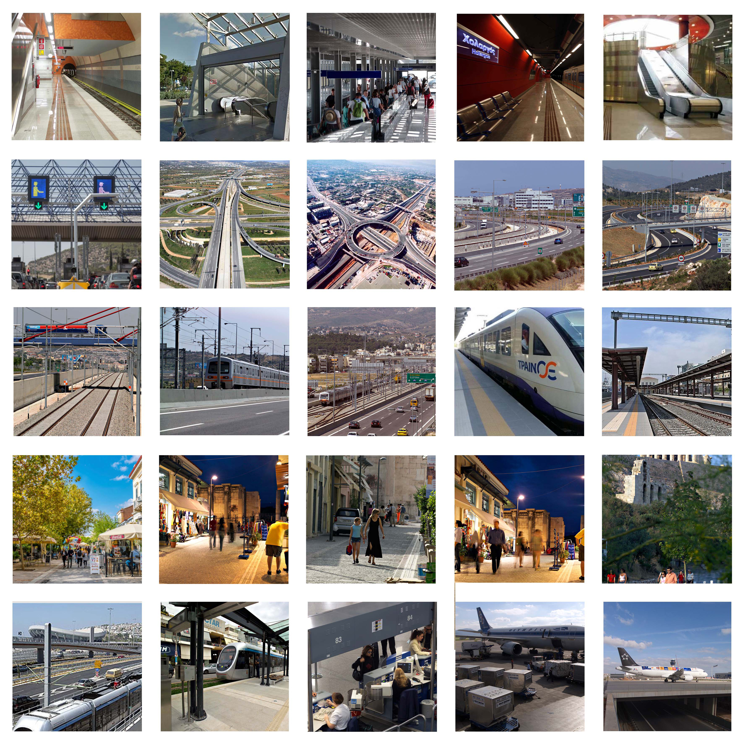
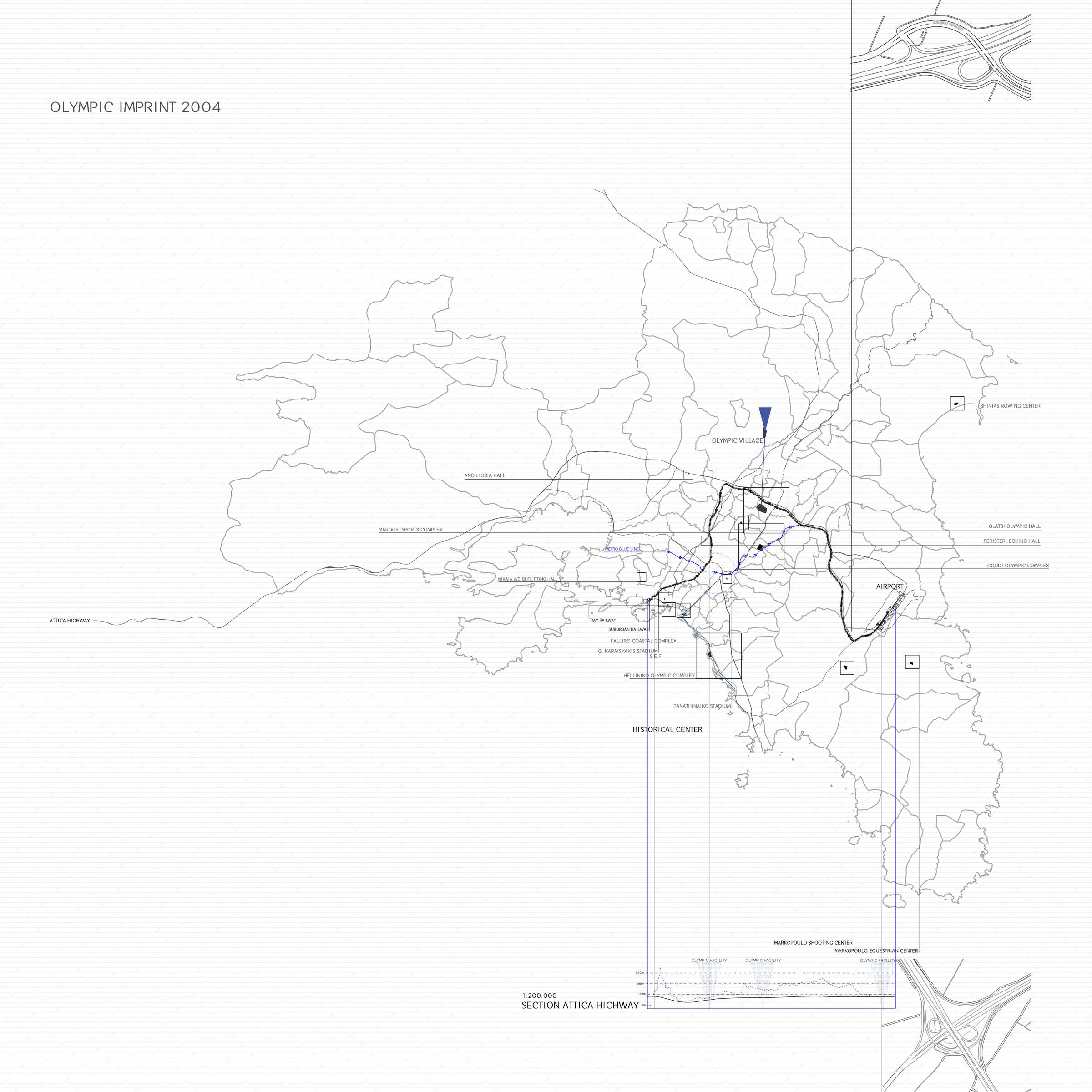
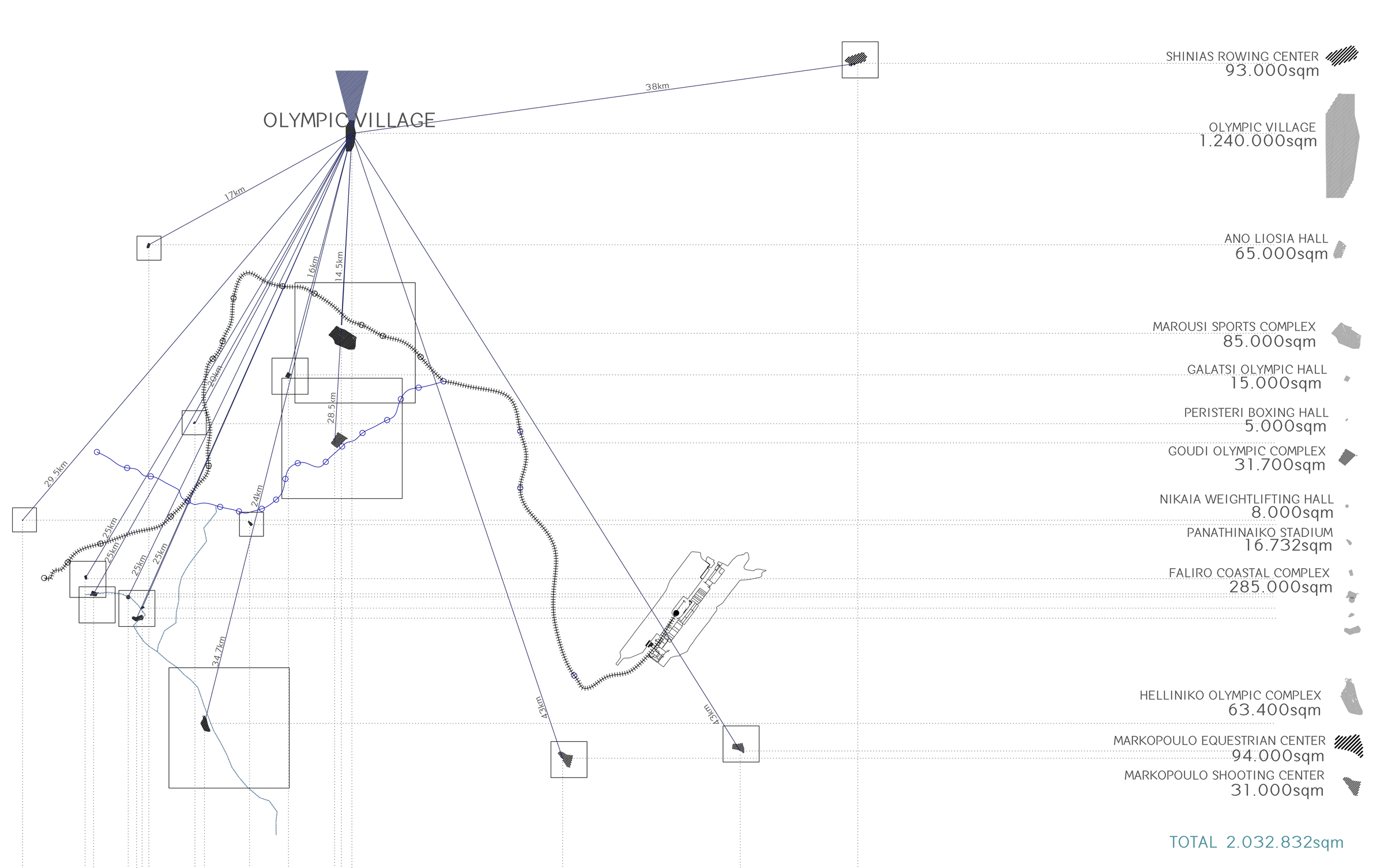
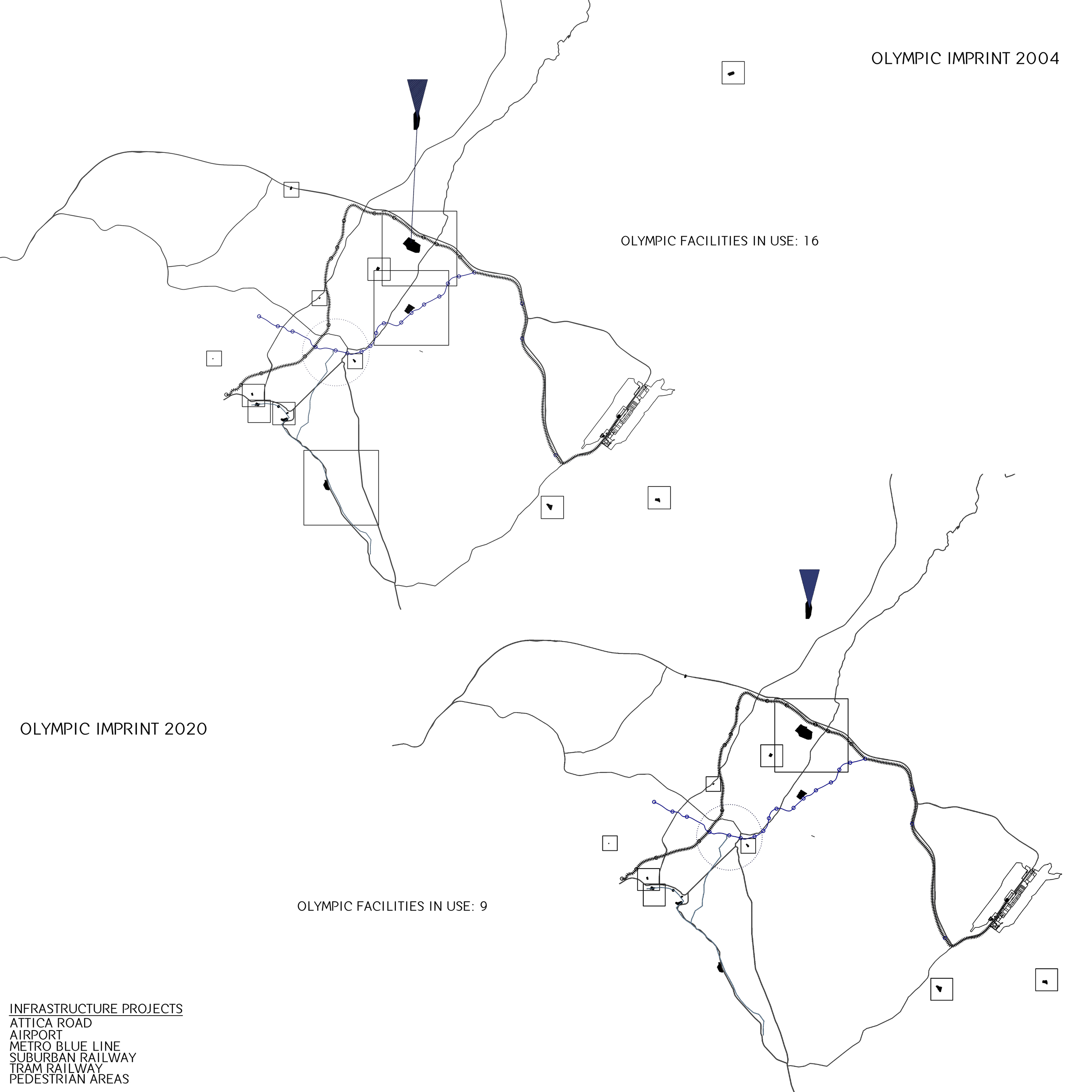
olympic city v.2
Eleftheria Pyroudi, Yannis Tsagklis
Olympic Imprint
2 0 0 4
Athens of 2004 played a very key role in the image of Athens as we know it today. With the organization of the Olympic Games, Greece undertook to face a significant challenge that is part of a larger and even more ambitious goal: to give impetus to the modernization of the country and especially the capital. The large, long-lived infrastructure projects have significantly improved city traffic and upgraded its cultural heritage: it is the construction, expansion and improvement of the metro; the tram network that favors the opening of the city to the sea; the highway and connecting roads that facilitate access to the international airport; the pedestrian network for the unification of archeological sites. Thanks to these changes, which will contribute to the successful holding of the XXVIII Olympiad, Athens will show a new image to the millions of visitors and spectators from around the world.
2 0 2 0
Facilities not in use since 2004 are being demolished on a daily basis. The BBC correspondent describes it.
"It simply came to our notice then. It seems that they have given up. There is no longer the money to build air conditioning in the main part of the track and field facilities in Athens. It makes sense for athletes to warm up and suffer. Everything is falling apart, the cement is worn out and the parts are now rusty. The facilities are being dismantled in just 8 years".